
Exclusive System Per Region
Dominate Your Area
Our Satellite Data & IP Targeted Ads will 3x your roofing efforts!
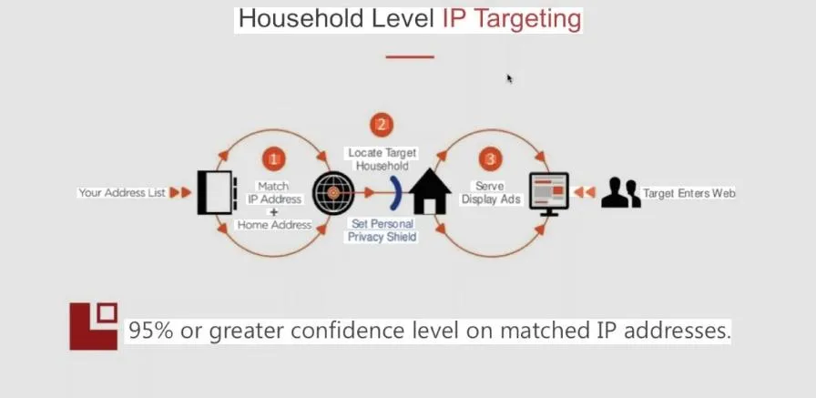
Our Proprietary Targeting Edge: Satellite+ IP Precision – Exclusive to You
We’ve built a one-of-a-kind, in-house system that no one else offers: real-time drone reconnaissance fused directly with household-level IP targeting.
Because this technology is so powerful and gives such a massive first-mover advantage, we only partner with one roofing contractor per territory. Once your area is claimed, it’s locked—no exceptions.
You get exclusive access to the sharpest, most unfair lead-generation weapon in the roofing space.
Spots are extremely limited and moving fast.
Roofers: You're Overpaying for Leads by 30–50% — Leaving Thousands on the Table Every Month
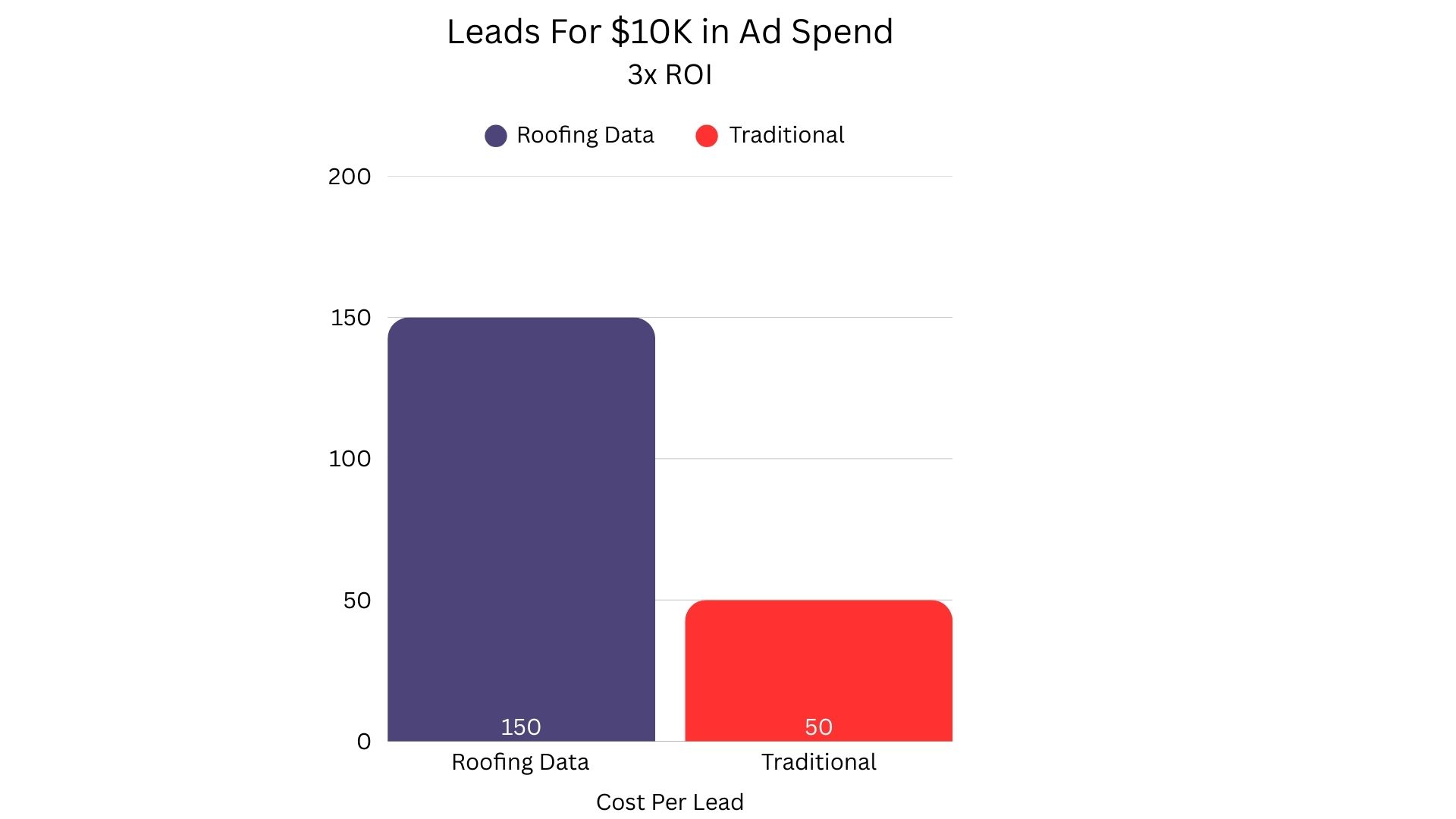
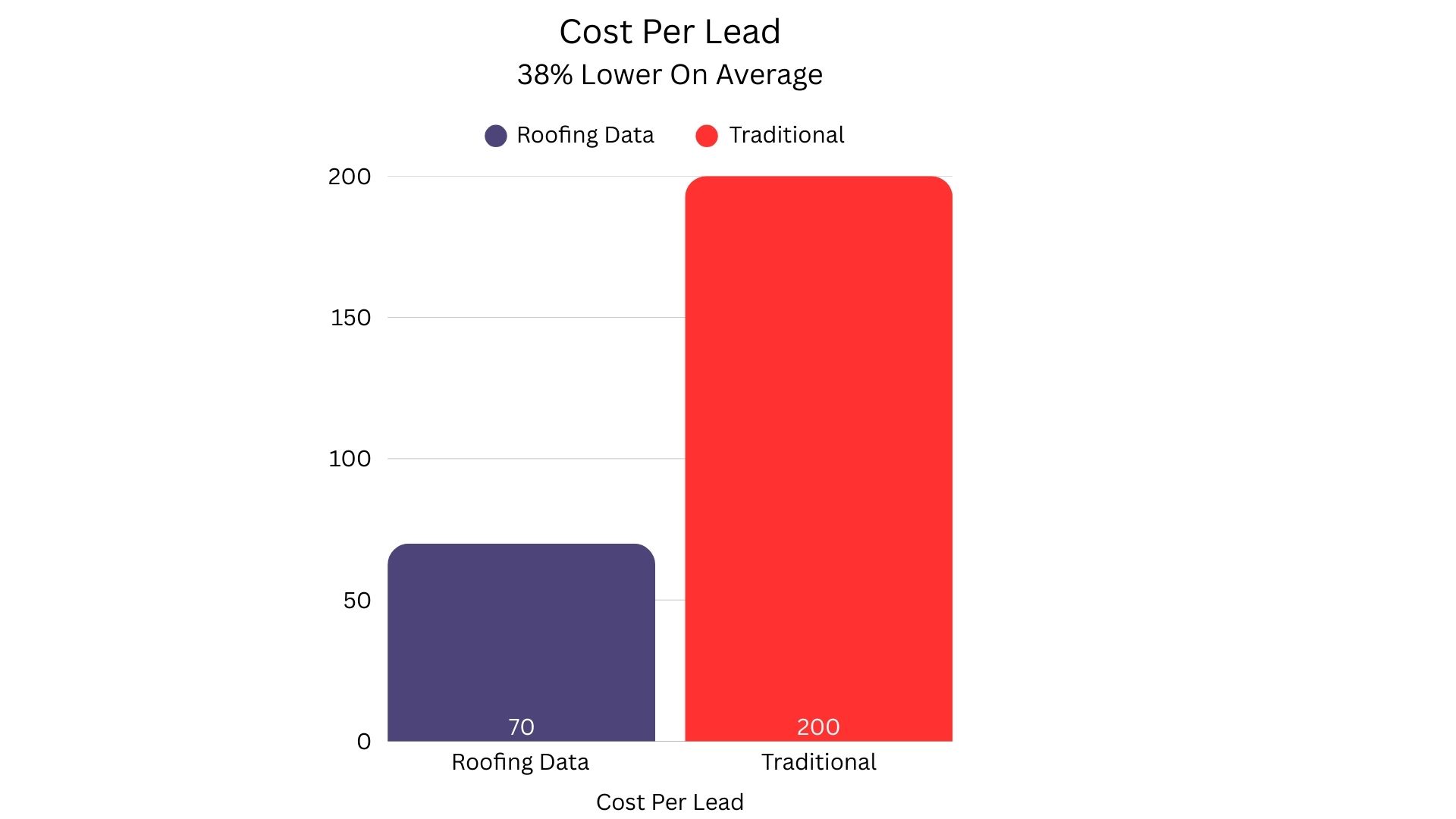
Nationwide, qualified roofing leads average $150–$300. Traditional tactics like broad ads, cold calling, or door-to-door waste valuable time, is financially costly and will drive cost per lead higher generating fewer jobs.
Without targeted data, you're paying more to get less—easily $500,000+ in lost revenue annually for many contractors.
Our data-driven approach cuts CPL by 1/3 and boosts leads by 50%+ from the same spend. Result: more inspections, higher close rates, and extra revenue per year.
Sticking with old methods isn't just inefficient—it's costing you deals. Check the charts to see the difference.
Ready to stop the bleed and start winning more jobs? Let's talk.
🛰️ Satellite Data Collection
High-resolution satellite imagery is used to capture broad, up-to-date overhead views of properties.
These images provide accurate roof outlines, pitch estimates, and area measurements across large geographic areas.
Satellites can revisit sites regularly, enabling historical comparison and change detection over time.
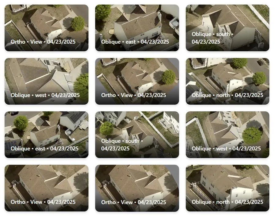
🚁 Drone Aerial Capture
Drones fly directly over a property to capture detailed, close-range images from multiple angles.
They collect high-resolution photos and videos that reveal finer features like:
-Ridge lines and valleys
-Chimneys and skylights
-Venting and flashing details
The imagery is often precise enough for 3D modeling of roof surfaces.
📐 Data Processing & Modeling
Both satellite and drone imagery are processed using advanced algorithms to:
-Stitch overlapping images into seamless maps
-Build 3D roof models (orthomosaics and point clouds)
-Calculate roof pitch, surface area, and material quantities
The result is highly accurate, scalable roof measurement data suitable for estimates, planning, and reporting.
Total Available Lead Count For Your Area Will Be Provided During the Appointment. Please Let Us Know The Locations You Want To Target While Filling Out The Form.

Mint Media is a full-service digital marketing agency that helps great companies grow their revenue online. Get in touch: , +1 201-689-5550
|© 2026 Mint Media Solutions LLC. All Rights Reserved.